In North Queensland’s remotest corners, drone technology is giving conservationists and graziers an unprecedented view of the Great Artesian Basin (GAB) springs, helping guide restoration across some of the region’s most fragile ecosystems.
As groundwater-fed wetlands, the GAB springs provide refuge for potentially endemic plants and animals found nowhere else, making them some of Queensland’s most ecologically significant freshwater habitats.
Though there are more than 100 active springs scattered across the Northern Gulf region, many have been heavily impacted by historical groundwater extraction and prolonged drought, leaving them vulnerable to invasive plants and feral animals.
Biodiversity Officer Océane Dupont says drone imagery is helping the Gulf Savannah NRM team identify which pressures are affecting each ecosystem and measure how the springs adapt to management action over time.
“Pigs are one of the main threats to GAB springs as they dig around the edge and destroy vegetation looking for food, degrading the habitat for many invertebrate and plant species,” Ms Dupont said.
“Since we’re fencing the springs and controlling feral pig populations, we can use the drone imagery and assessment to monitor change over time and see how the environment around the springs is responding.”
Researchers are developing a tool that assesses drone images to automatically measure the percentage of soil impacted from either stock or pigs – a significant advantage when the latter have been disrupting wetlands in North Queensland since the 1800s.
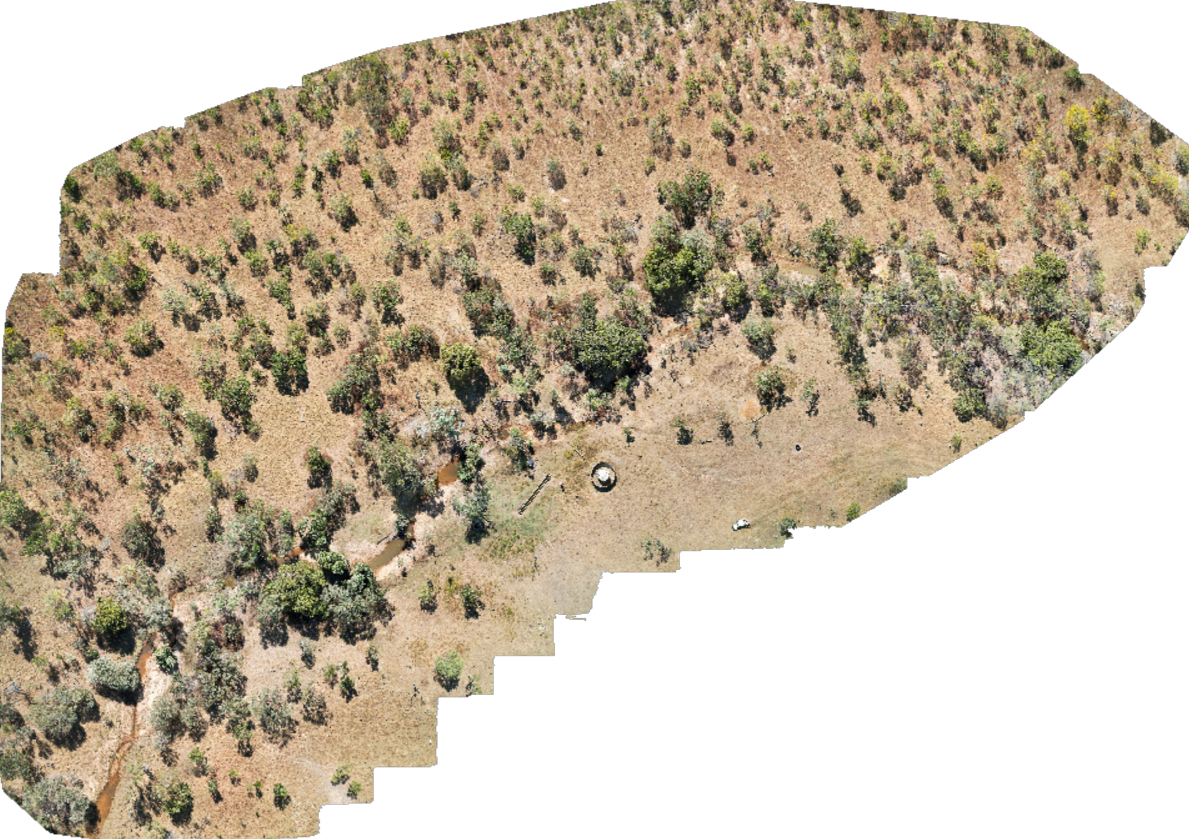
During the team’s most recent spring visit, hundreds of aerial photographs were captured before being digitally stitched into a single, high-resolution mosaic map spanning approximately 4.5 hectares.
While satellite imagery has traditionally helped researchers analyse broad-scale environments and document human impact, its comparatively coarse resolution can miss the finer details. Drone imagery fills that gap, providing a more comprehensive view of the springs and surrounding habitat.
Repeated surveys also create a consistent visual record, allowing researchers to track changes in vegetation and soil disturbance over time while reducing much of the subjectivity that comes with environmental interpretation.
“Everyone looks at the landscape differently, but drones give the capacity to go back and double-check how you’re imagining and interpreting your data,” Monitoring and Evaluation Officer Dr Lachlan Bailey said.
“This allows us to calibrate monitoring results between different people.”
In conservation, where ecological change often unfolds over years rather than weeks, both reliability and variety of data are invaluable.
Expanding the technological toolkit
To build a more complete picture of how springs respond to restoration, Gulf Savannah NRM is combining drone surveys with several other emerging technologies.
“We’re going to use camera traps and acoustic recorders to understand how fauna is using the source – what kind of birds, frogs and so on are coming and using the spring,” Ms Dupont said.
Environmental DNA (eDNA), which analyses the genetic material organisms leave behind in water and soil, will also be used to build an inventory of species present at each site.
Together, these technologies allow the researchers to look, listen and observe from multiple perspectives, with the ultimate goal of “protecting 12 hectares of GAB springs in the northern Gulf by improving water quality and vegetation recovery,” Ms Dupont said.
“One of the principles in environmental management is that you can’t protect, preserve or enhance something if you don’t know that it’s there.
“Drone imagery [alongside other tools] can give you greater capacity to understand what’s present in the landscape … so having that information is quite powerful.”
The growing use of drones reflects a broader shift in conservation science and practice, with studies showing the technology can improve the accuracy and efficiency of wildlife surveys while reducing costs, disturbance to animals and risks to field staff.
As a result, biodiversity teams right across the country are deploying drones to monitor everything from the critically endangered Far Eastern curlew in Queensland to southern right whales and pest rabbits in Victoria.
Beyond conservation programs, Dr Bailey believes their increasing accessibility also has enormous potential for landholders, graziers and anyone working with the land.
Democratising drones in land management
Until relatively recently, collecting aerial imagery often required aircraft commissioning or expensive equipment, placing this technology beyond the reach of many.
As drones become more affordable, however, they are changing that equation by allowing a variety of stakeholders to collect high-quality data themselves.
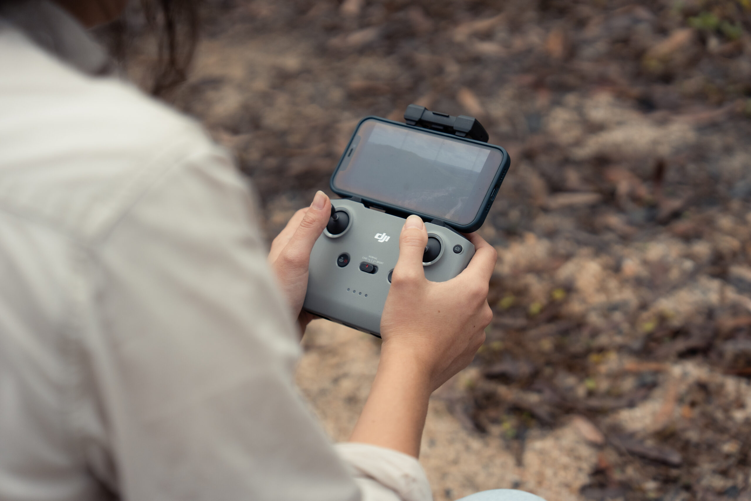
“Drones are gradually becoming more available to a wider segment of the population, empowering landholders, land managers and anyone working in the environmental space to collect their own data, do their own monitoring, and support their own projects,” Dr Bailey said.
“The fact you can survey everything remotely with the drone is a lot safer, especially when there are floods and access constraints.”
For graziers across the Gulf, where long wet seasons can leave paddocks isolated for months, drones are increasingly being used to check infrastructure, locate livestock and monitor country while avoiding dangerous floodwaters and crocodile habitat.
Industry case studies confirm grazing enterprises are one of the sectors with the greatest opportunity to benefit from drone usage, reducing time spent traversing difficult terrain and lowering risks associated with remote property access.
Ultimately, the same qualities that make drones invaluable in conservation are also driving their adoption across multiple industries. Modelling from the Australian Government estimates drones could deliver $2.95 billion savings across agriculture, forestry and fisheries over the coming decades, all while improving workplace safety and increasing productivity.
While nature and technology seem unlikely partners, projects like this demonstrate that conserving some of North Queensland’s most fragile ecosystems may begin with seeing them differently – from the skies, and beyond.
This project is funded by Queensland Government’s Natural Resource Management Expansion Program (NRMEP).